US strategic drone conducts reconnaissance flight over Donbas
An American RQ-4A Global Hawk strategic drone conducted reconnaissance flight along the demarcation line in the Donbas, Interfax Ukraine reports with the reference to the data published by aviation sources.
After taking off at the Naval Air Station Sigonella in Italy, the American drone spent 10 hours flying along the demarcation line between Ukraine and the self-declared Donetsk and Luhansk People’s Republics (DPR and LPR), remaining in Ukraine-controlled airspace.
On several occasions during the flight, the aircraft came within 40-55 km of Russia’s Belgorod, Voronezh and Rostov provinces, which border with Ukraine’s Luhansk province.
With its 200 km observation radius, the RQ-4A Global Hawk would have been able to observe the entirety of the DPR and LPR, as well as a large area of the bordering Russian provinces.
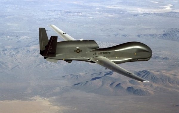
The RQ-4 is the world’s largest reconnaissance drone, equipped with a high-resolution camera, infrared sensor and radar to track moving objects.
When at high altitudes, the aircraft can survey large areas and lock on to specific targets, transmitting reconnaissance data in real-time through satellite communication channels.
The Global Hawk has a take-off mass of 15 tons and a wingspan of roughly 40 meters. It can patrol for 30 hours at an altitude of up to 18,000 meters. Its cost is estimated at $140 million, and one hour of flight time costs in excess of $31,000.
Since the start of 2018, the US Air Force’s drone has been used regularly to carry out reconnaissance flights close to the DPR and LPR, as well as the Russian borders in the Baltic region and on the Black Sea.